|
The Wrack Line is a newsletter for partners, participants, and data users of NOAA's Marine Debris Monitoring and Assessment Project (MDMAP).Thank you for reading!
Above from Hiis L., Stamford, Connecticut
Messages from the NOAA Team
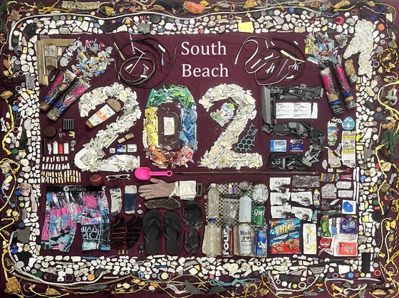 A surveyor at South Beach, Oregon arranged their debris from a year’s worth of MDMAP surveys. (Photo Credit: Shelby S., Oregon Coast Aquarium)
2025 Reflection
We hope you had a wonderful holiday season and wish you joy and abundance in this new year. The NOAA Marine Debris Monitoring and Assessment Project could not be what it is without your participation, and we are grateful for all that you do.
In 2025, volunteers:
- observed nearly 74,000 items;
- visited 205 sites;
- conducted 947 surveys;
- led by 48 organizing groups/site leaders; and
- engaged over 1,100 first-time MDMAP participants!
Check out the 2025 debris breakdown below! What do you think will wash up in 2026?
Sincerely, The MDMAP Admin Team
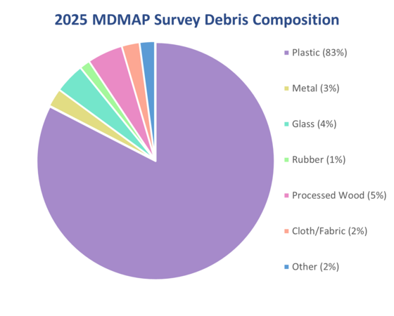 A pie chart showing the debris breakdown of the 947 MDMAP surveys completed in 2025. (Credit: NOAA)
Verification Timeline
This past year, we’ve seen an influx of data submitted to the database. As a result, the review period for surveys may take longer than usual. We ask that participants keep these considerations in mind when completing surveys and planning data analysis.
- Does your MDMAP data need to be verified by a specific date? We can work with you. Please reach out to us with your needs and deadline.
- Hold on to your field data sheets should our team have questions during verification.
- While optional, taking detailed notes and photos during your survey can help preserve what you saw if our team has any follow-up questions.
We appreciate your patience during survey verification!
Participant Highlights
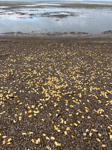
What's Popping?
This Ohio shoreline was covered in corn upon the Port Clinton Beach survey team’s arrival for their December survey.
Thankfully, corn kernels do not meet the definition of marine debris and are too small to be counted in MDMAP surveys, so the team didn’t need to spend any extra time counting these.
Photo Credit: Basia G.
|
|
 |
Student Inspiration
A history student at the University of Connecticut (UConn) learned how to conduct MDMAP surveys during a study abroad experience with Community Collaborations International in Puerto Rico.
Upon returning to UConn, they realized there were no MDMAP sites in their home state and set out to change that. With assistance from three other students and support from UConn’s Summer Undergraduate Research Fund, they established 44 MDMAP sites at public beaches along Long Island Sound this past summer. The student plans to apply what they’ve learned from their experience by producing an educational zine, data report, and in their future classroom as a teacher.
Help keep these monitoring efforts going. Check out the site map and let the MDMAP team know if you’re interested in continuing surveys at any of these available Long Island Sound sites!
Photo Credit: Hiis L., University of Connecticut
|
|
 |
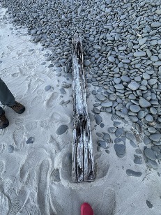
Helping Hands Across Agencies
Surveyors with the North Coast Land Conservancy in Seaside, Oregon, worked with the Oregon Parks and Recreation Department to remove a railroad tie from their MDMAP site.
If you encounter large debris while surveying, rather than moving it yourself, we recommend contacting local agencies. When reaching out, be sure to include the location, date of observation, the type of debris you found, and, if possible, photos of the debris.
Not sure who to call? Reach out to one of the Marine Debris Program’s Regional Coordinators who may be able to connect you to the right channels.
Photo Credit: North Coast Land Conservancy
|
|
 |
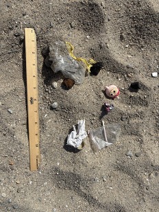
From COASST to Coast
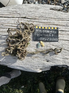
At the beginning of 2025, the Coastal Observation and Seabird Survey Team (COASST) concluded their longstanding marine debris survey module supported by funding from the National Science Foundation. In an effort to help volunteers who wanted to continue combing beaches for debris in a scientific manner, NOAA’s MDMAP team helped interested COASSTers transition to the MDMAP protocol.
With this support, two participants continued marine debris surveys at their site on Fidalgo Island, Washington, submitting eight surveys in 2025. Their COASST chalkboard used in the photo (right) helps to provide scale and context for where the debris was found.
Photo Credit: Natalie N. and Ann R.
|
|
 |
Safety First!
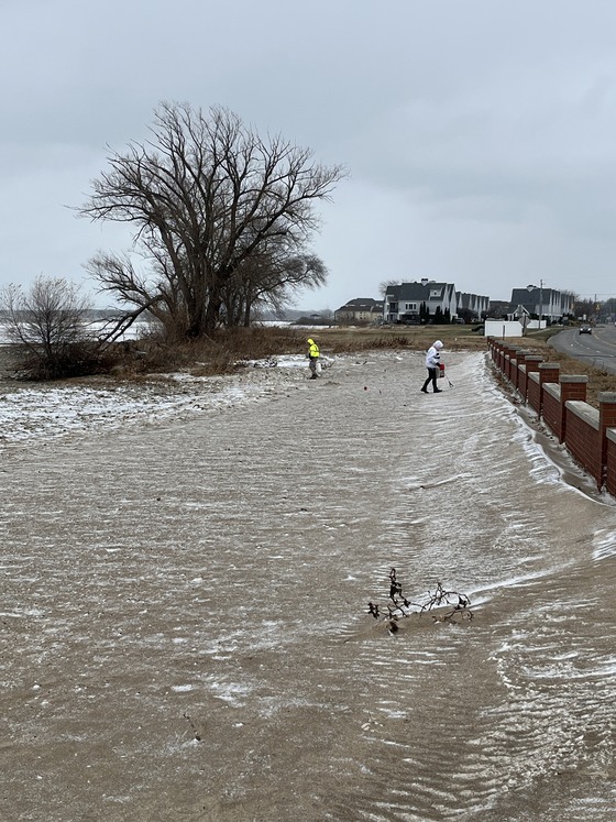
Survey activities in the Northern Hemisphere tend to diminish as winter weather intensifies. Here are tips to reduce risks during surveys:
- Check the weather and tide forecasts before heading to your site and reschedule the survey if conditions are not suitable.
- Avoid turning your back to the water or have a spotter to watch for sneaky waves and other hazards along the shoreline.
- Get familiar with flora and fauna in your area that could sting, pinch, or bite!
- Gear up with weather appropriate attire and a stocked first aid kit alongside your survey tools.
No matter the season, your health and safety is the highest priority!
Data Entry Tips: Time After Time
Surveyors are asked to record time twice—this isn’t a mistake! Let’s break down the difference:
The Total Survey Duration on the Survey Coversheet is meant to capture how long it took to complete the entire survey at the site. Total Survey Duration should include the time required to:
- travel to and from the site;
- set up and breakdown;
- conduct the survey; and
- categorize items (if this step is completed while on site).
On each Transect Survey Form, the Search Time is intended to capture how long it took to search each transect for debris. There are a few considerations for this field:
- If you categorize debris during the survey, include it in the search time. If you categorize after, please stop the clock before starting.
- If you miss tracking the Search Time, please don’t estimate. Instead, keep the default search times set at 00:00 to 00:00.
For more information, look at the datasheets. Each field has a short description of what to consider when entering data.
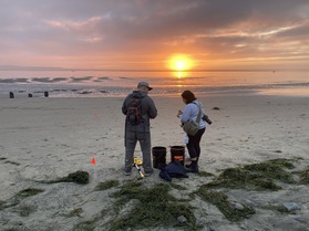
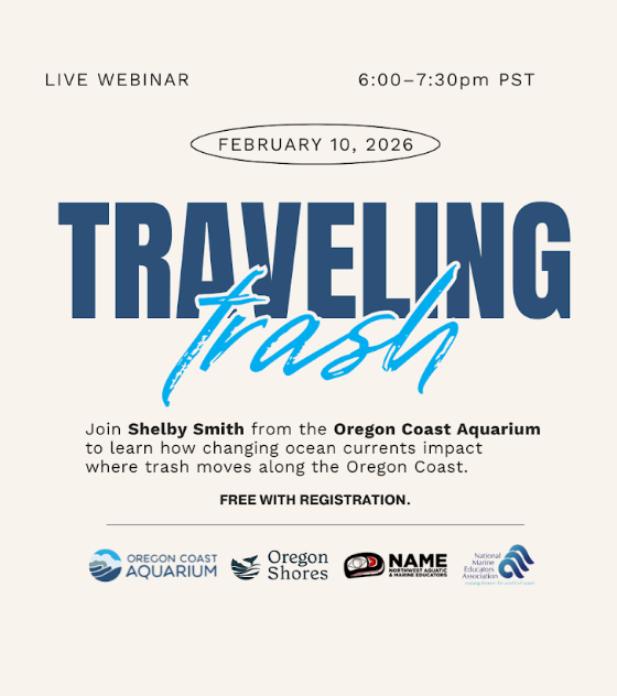
Upcoming Webinar
Curious about how the collage of debris at the top of the newsletter came to be? You can hear more about it during a webinar on Tuesday, February 10th, 2026.
Shelby Smith of the Oregon Coast Aquarium will be sharing the story behind seasonal marine debris patterns along the central Oregon coast. Using MDMAP and Nurdle Patrol data collected throughout 2025 with Oregon State University, she’ll uncover how tides, storms, and currents shape what washes ashore, and what that means for our ocean's health.
The full event details are live on the event webpage. After registering for the webinar, participants will automatically receive the Zoom link to join the webinar during the scheduled event time.
Training Videos
Project Video
Click on the image below to view a short video about MDMAP. Share the link to spread the word about this project!
|