Scientists make new discovery in the history of the Giant’s Causeway
Latest news from the British Geological Survey

Having trouble viewing this email? View it as a Web page.

BGS Latest News
A landscape image of the Giant's Causeway, which shows the basalt columns.

Scientists make new discovery in the history of the Giant’s Causeway

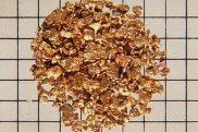
New research by the Geological Survey of Northern Ireland and BGS, has changed our scientific understanding of Northern Ireland’s volcanic past revealing that the volcanic rocks of the region formed in just 5.5 million years –  8 million years less than previous estimates.

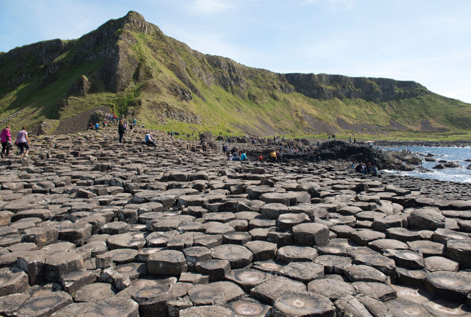
Using state of the art techniques, scientists have been able to reconstruct a new timeline for volcanic activity across Northern Ireland. It now firmly connects the Earth processes that caused the development of the Giant’s Causeway and the broader Antrim Plateau area, along with the Mourne Mountains and Slieve Gullion, to a globally significant volcanic event seen in rocks as far away as Greenland and known as the North Atlantic Igneous Province around 60 million years ago.

This work is part of a wider initiative at the British Geological Survey to improve the understanding of the UK’s geology through better quantifying geological time in the rocks around us.

Two stacks of photovoltaic panels sit on wooden pallets

Shortage of end-of-life materials presents challenge to UK critical minerals security

New analysis from the UK Critical Minerals Intelligence Centre provides an assessment of the UK’s future demand and secondary supply availability for key critical metals.

The report reveals insufficient end-of-life material stocks present a supply risk over the coming decade, but offer significant long-term potential to meet critical mineral demand through recycling.

A row of houses in London, with a pavement in the middle of the image and cars parked on a road to the right hand side.

Latest research emphasises climate-related subsidence risk to millions of British homes

Shrink–swell ground movement, typically reported as subsidence, is one of the most damaging geohazards in the UK today, presenting a significant and growing environmental costs. 

New maps produced by BGS form part of the new GeoClimate Shrink–Swell dataset, which now includes outputs for low, medium and high emissions scenarios, and additional projected time intervals to 2070.

In other news

Dr Maggy Heintz speaking at the UK/Ukraine Memorandum of Understanding event

Ukraine and the UK strengthen their commitment to geological cooperation

Ukraine and the UK have reaffirmed their strategic partnership with the signing of a new Memorandum of Understanding (MoU) to collaborate on geological science and resource development.

The agreement underscores a shared commitment to Ukraine’s long-term economic recovery while deepening bilateral ties. Amid increasing global demand for critical minerals essential for technologies such as renewable energy systems, batteries and electronics, it also signals a growing focus on the role of natural resources in strengthening economic resilience and energy security.

The Diamond Light Source Facility. © Steven Ross.

UK and Philippines scientists investigate natural hydrogen generation processes at atomic scale

BGS scientists have recently undertaken research on rock samples from a hydrogen-generating system using the Diamond Light Source facility in Harwell. The new, atomic-scale data will provide a better understanding of the geochemical controls driving the hydrogen-generation process.

Distribution of sites in the new release. The added sites are in pink, the previously released in blue.

UK geothermal catalogue receives update

BGS has released the second digital version of the UK geothermal catalogue of subsurface temperature and rock thermal conductivity measurements and heat flow calculations.

The platform provides national- to local-scale information on geothermal potential across shallow and deep technology options. The new update includes the addition of nearly 14,000 more data points derived from 1800 sites to inform geothermal assessments. 

Alluvial gold. BGS © UKRI. (P102730)

From archive to discovery: historical mineral reports support gold exploration in Scotland

Compiled largely during the 1970s and 1980s, Mineral Exploration and Investment Grants Act (MEIGA) reports contain a rich variety of information, including geological mapping, soil and stream sediment geochemistry, geophysical surveys, drillcore logs and assay data. A new release of 660 digitised reports have now been made available online ready to support further mineral exploration.

A hand holding rock core. Below more core is stored in plastic bags inside a cardboard box

Newly released core could hold clues on potential mineral prospectivity in Perthshire

A comprehensive collection of over 700 geological samples from the vicinity of a former mine in Scotland is now available to scientists for further research.The sample set, comprising outcrop and drillcore, was originally collected in the 1980s by Dr Norman Moles, who was undertaking research on the Foss deposit for his PhD at the University of Edinburgh. The fully catalogued collection of 717 specimens will be of interest to scientists for a range of further studies.


This email was sent to NPxrji73qy@nie.podam.pl using Granicus Communications Cloud on behalf of: British Geological Survey · British Geological Survey, Keyworth, Nottingham, NG12 5GG GovDelivery logo